A master plan for the redevelopment of the former Post Office site in the Pearl District has been presented to the Design Commission. Known as the Broadway Corridor, the full build-out the site will include approximately 4 million square feet of new commercial, employment, and residential development. The concepts by ZGF Architects build on the 2015 Framework Plan, which was used as part of the decision making process when the city purchased the site. Developer Continuum Partners of Denver is acting as an adviser during the master planning process.
The entire 14 acre site was formerly taken up by USPS operations, which were originally located in the area for the proximity to the now gone rail yards. The site was purchased in 2016 by Prosper Portland and the Portland Housing Bureau for $88 million. The sale price allowed the Post Office to build a new facility on NE Cornfoot Road, near the airport. The use of the site as a processing and distribution center ended in 2018, following completion of the new facility. The retail operation on NW Hoyt St is still operating.
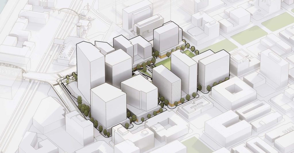
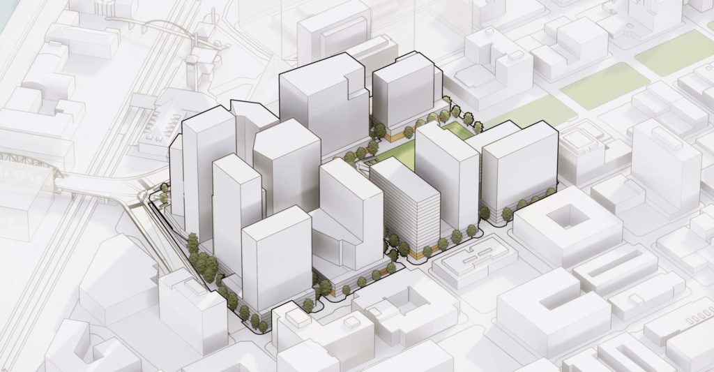
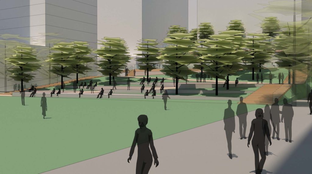
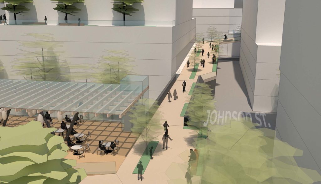
The master plan proposes that NW Johnson St would be extended through the site as an 80′ wide right-of-way, allowing for protected bike lanes and wider sidewalks on the north side of the street. NW Park would be extended north to Johnson as a public street, and would exist as an easement between NW Johnson and Kearney. NW Irving St and Kearney St would exist in parts as privately owned driveways with public bicycle and pedestrian access, and in other parts as public access easements without vehicles. The North Park Blocks would be extended to NW Johnson.
The new street layout would create eight blocks, including a large superblock at the north of the site, where it abuts the NW Lovejoy ramp to the Broadway Bridge. The other other seven blocks would be similar in size to a typical Portland city block.
The Portland Housing Bureau would own two half-block parcels, which would be offered to affordable housing developers. Affordable housing on the rest of the site would be created through the city’s Inclusionary Housing policy.
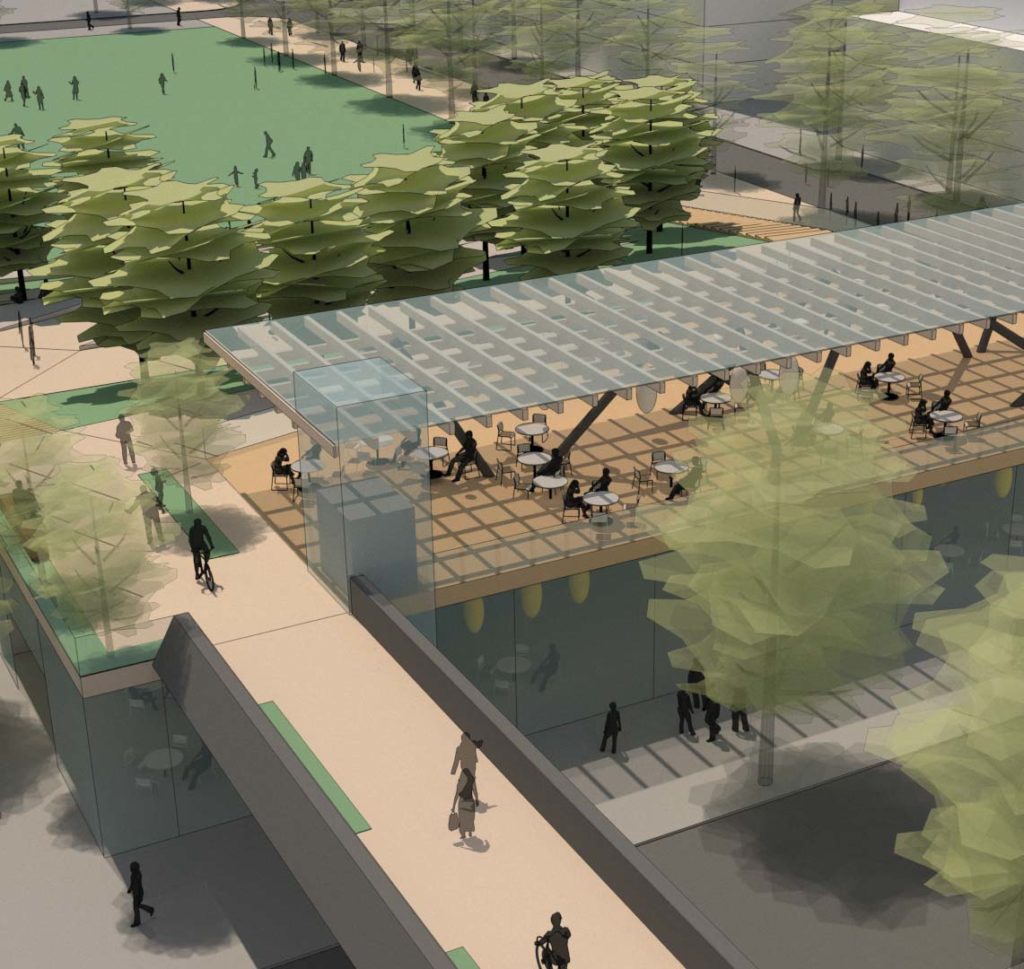
Parking would be provided in above-grade podium structures, in order to avoid removal of contaminated soil.
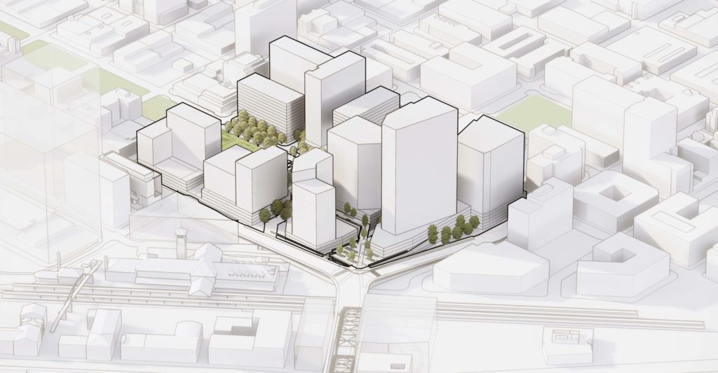
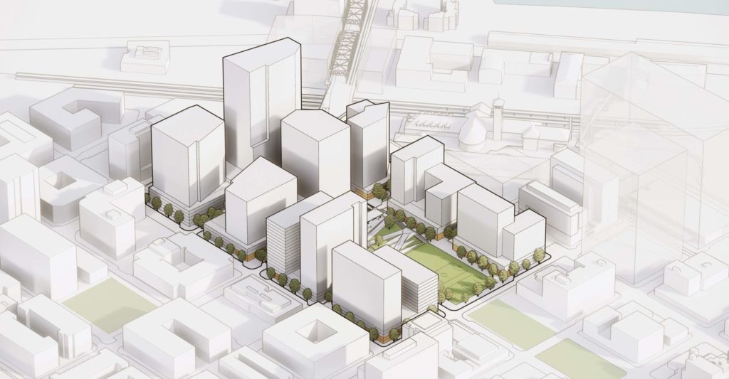
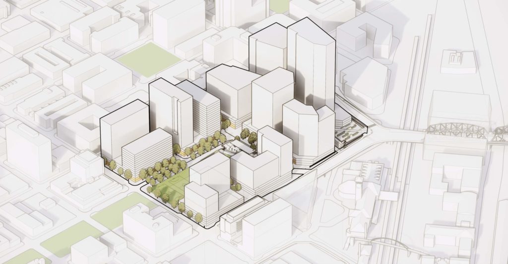
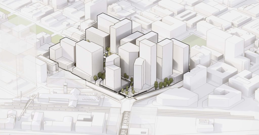
Massing Options
Minimum building heights throughout the site would be set at 100′. Heights of up to 250′ south of Johnson and 400′ north of Johnson are allowed under zoning that came into effect in 2018.
Massing of the individual buildings would depend on their program. One massing option, shown in the images above, illustrates the potential for two larger office towers on the north superblock. A second option, shown below, assumes three residential towers on the north superblock.
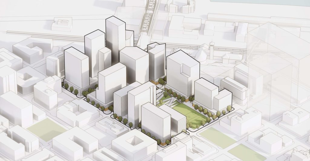
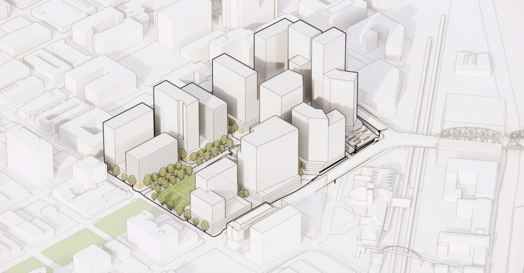
Development would be take place in three phases. Phase 1 would include all blocks north of Johnson, and Parcel 5 on the half block facing Johnson at 9th. Phase 2 would include the two blocks south of Johnson between Broadway and NW 8th. Phase 3 would include the remaining parcels at the southwest corner of the site and the extension of the North Park Blocks. The existing parking garage would be retained for interim use, including a relocated Postal Service retail operation, until Phase 3 begins.
Green Loop
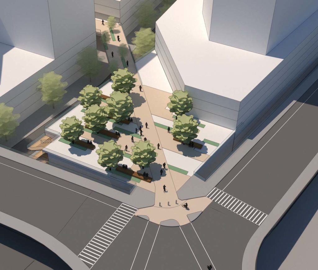
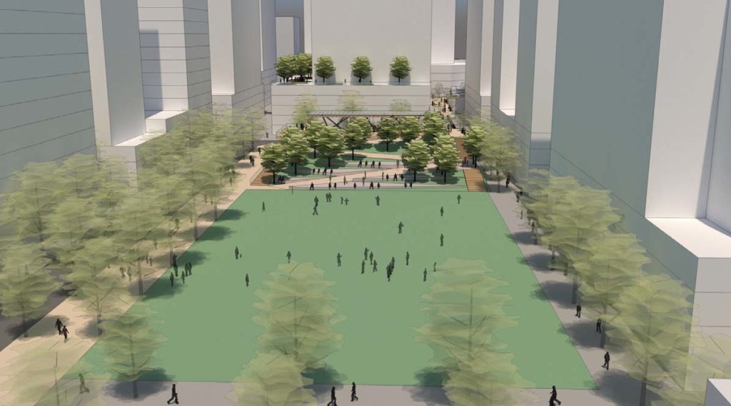
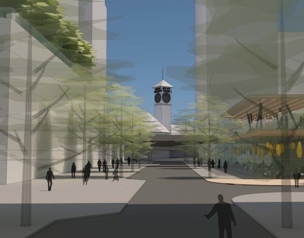
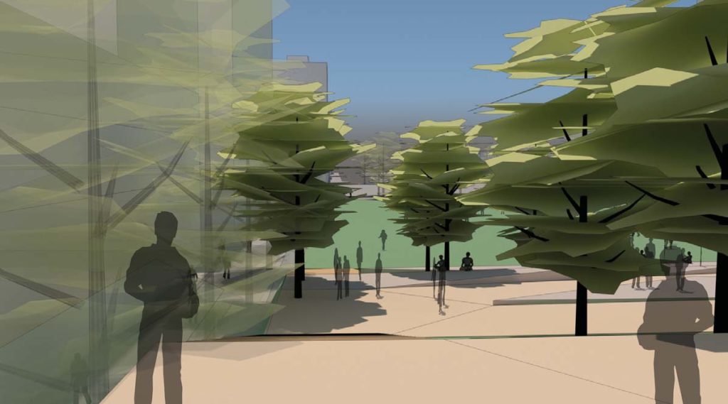
The Broadway Corridor will form part of the future Green Loop pedestrian and bicycle oriented linear park. An elevated plaza above structured parking is proposed at the intersection of NW Lovejoy and Broadway, at the approaches to the Broadway Bridge.
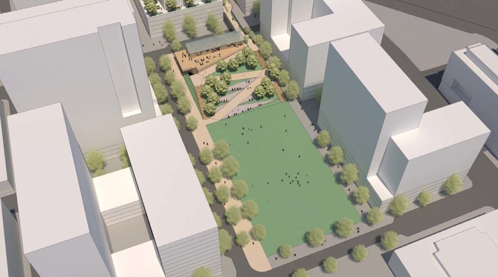
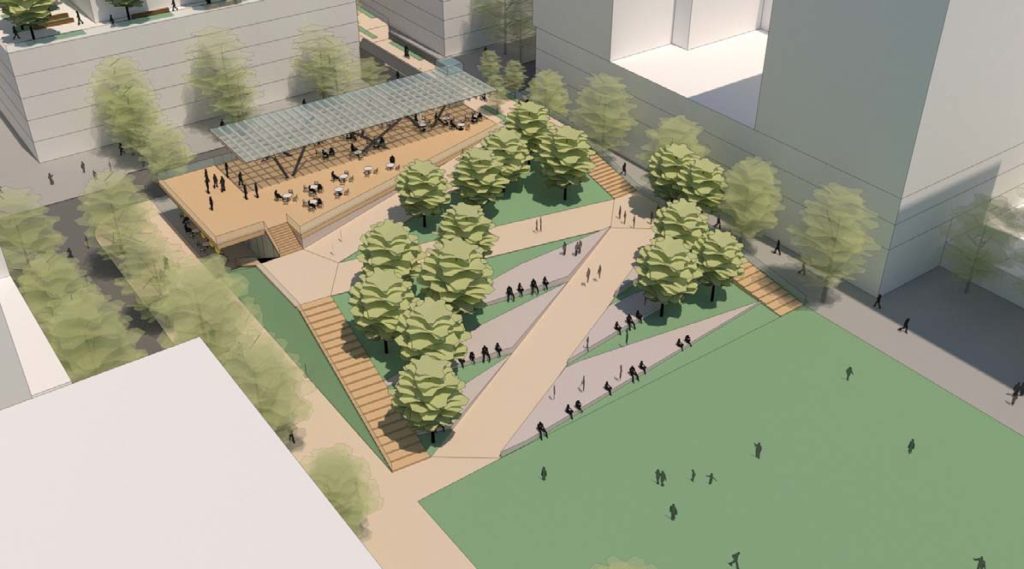
The loop would pass over NW Kearney and Johnson on bridges, and arrive at a pavilion structure south of Johnson. A series of landscaped stairs and ramps would bring the Green Loop down to ground level, where it would then continue along the curbless NW Park Ave. A pedestrian promenade on the alignment of NW 8th Ave would be created at the eastern edge of the North Park Blocks.
The Broadway Corridor Master Plan has been presented to the Design Commission at two Design Advice meetings, held on June 6th and July 18th, 2019. As described in a summary memo, areas of discussion included: when the Green Loop and park elements would be built, and who would be responsible for building them; the activation along NW Kearney; and the impact of above grade parking.
The masterplan for the Broadway Corridor will be subject to a Type III Central City Master Plan review, with public hearings in front of the Design Commission. Designs for the individual buildings will also be subject to Type III Design Reviews.
Drawings
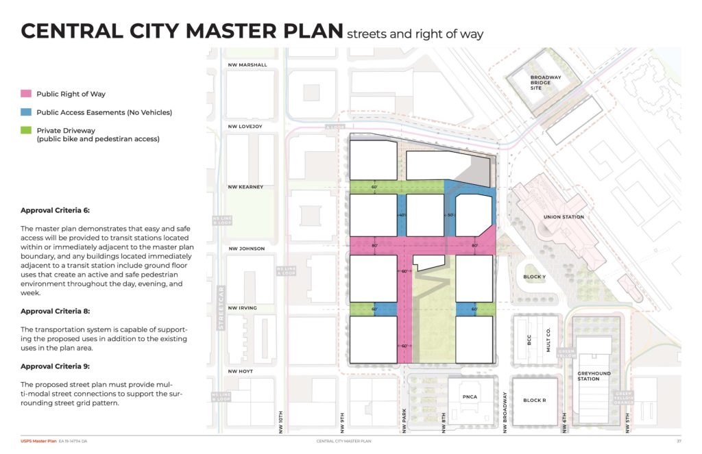
Plan | Streets and Right of Way 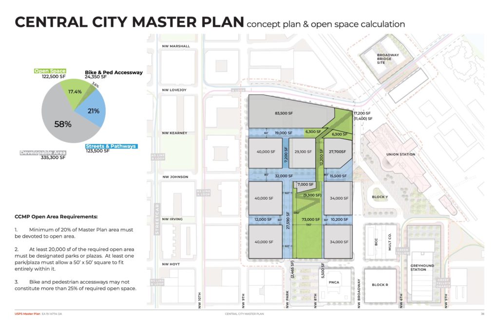
Plan | Open Space & Circulation 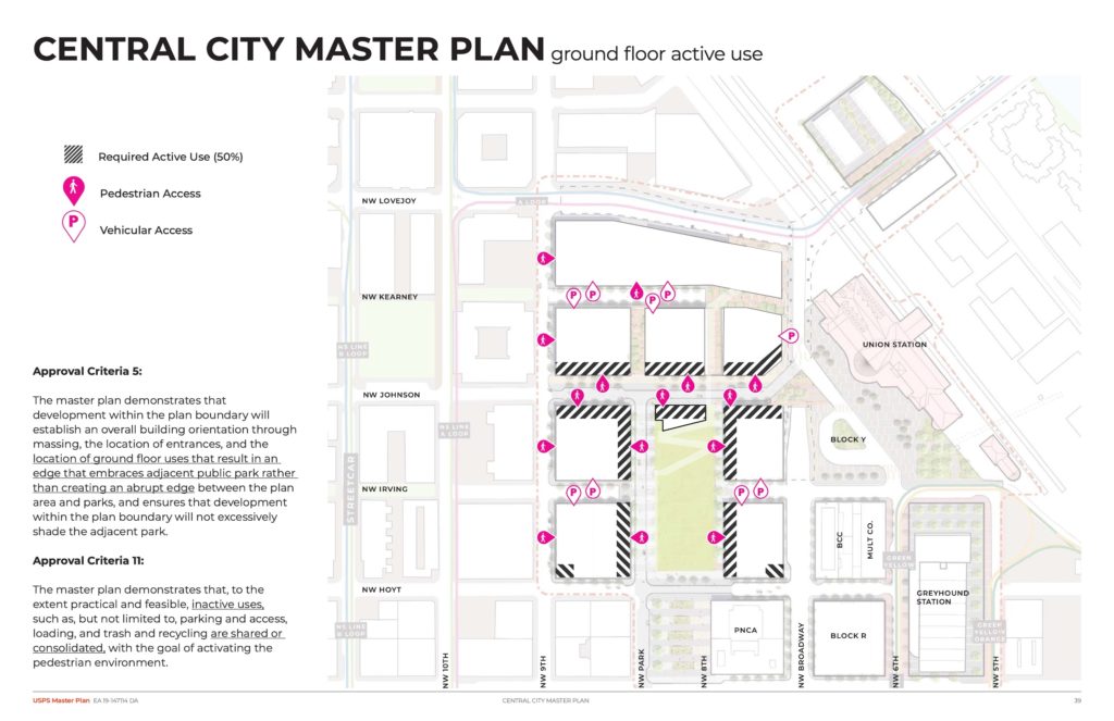
Plan | Active Uses 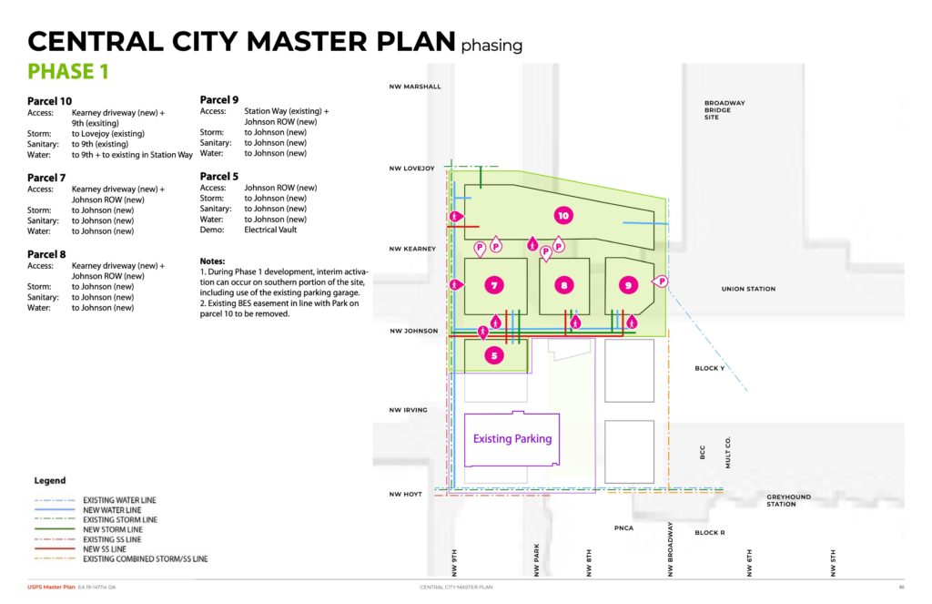
Plan | Phase 1 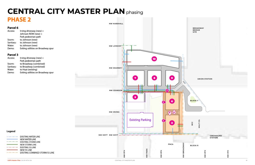
Plan | Phase 2 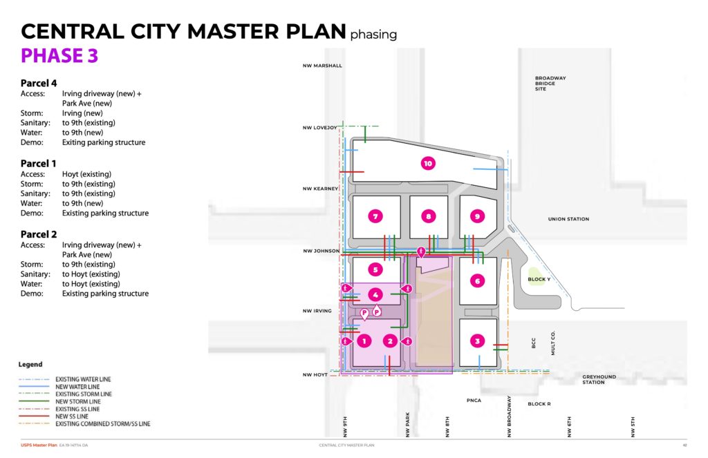
Plan | Phase 3 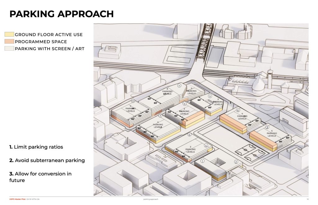
Diagram | Parking Approach 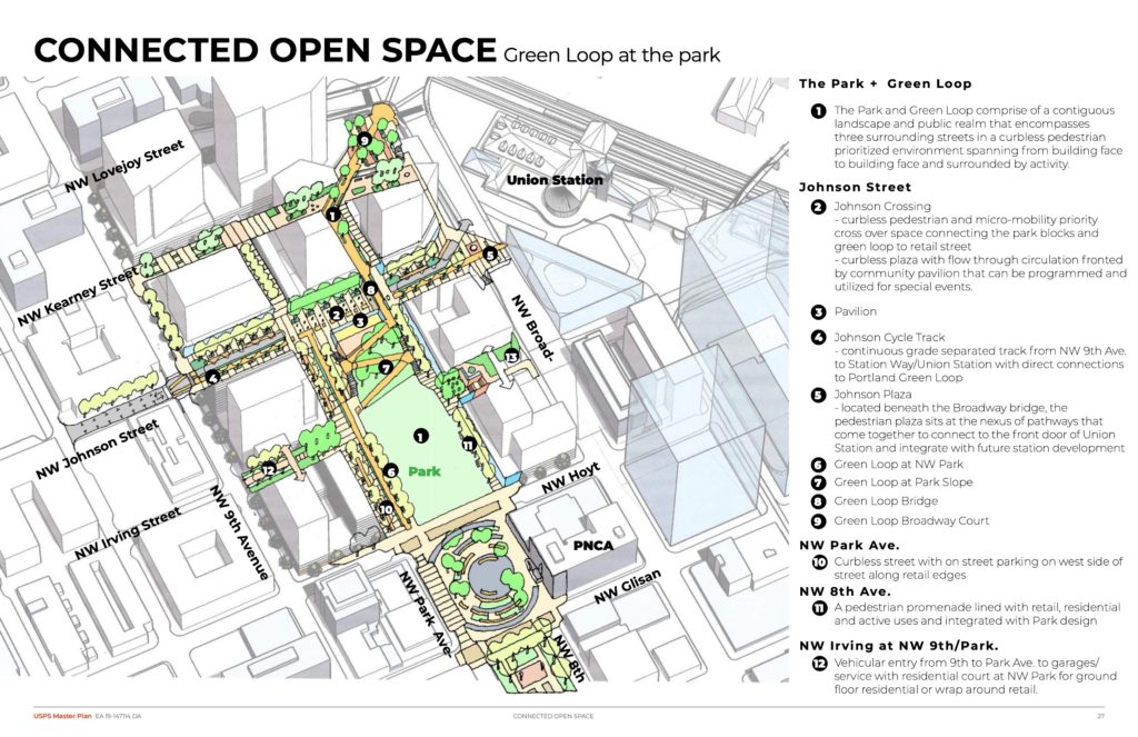
Diagram | Connected Open Space
This will probably be all finished a generation from now.. meh
Wonder how they’re going to compel PNCA to transform their surface parking into an extension of the north park blocks? They mention extending, but that land is outside the southern limit of the plan.
Mr Libby.. do u even think this project will start anytime soon ? Let alone be fully finished in our lifetime?
Portland Parks & Recreation already owns that surface parking lot. Its just a matter of them getting their financial affairs in order so that they can actually develop it as a park.
I’m really hoping they change the bike circulation here. Switchbacks with bikes and peds mixed together is not a desirable condition that should be baked into a 100 year design.
I like the topographic change as an urban design element, but the project team needs to get the bikes off it.
I’m hoping this project can hit the next economic boom. Too late for this one, at least too late to get something nice without enormous subsidies..
The idea that 9 garage ramps and upwards of 40 levels of above-grade parking structure throughout the site is somehow “limiting parking” is ridiculous. And the impact that above-grade parking will have on the pedestrian and urban experience in this corridor is extremely concerning. Having above-grade parking for the viaduct-adjacent properties seems more defensible, so long as all the sides not fronting the underside of the viaduct are wrapped with housing/office space/etc.
There should be a more concerted effort to minimize parking. It would seem to make sense for one or two of the buildings include ALL of the parking for the master plan site (with significantly less overall parking than what is currently proposed), to minimize the number of garage entrances and potential conflicts with people walking and biking throughout the area.
Having a masterplanned site at this location, of all places, with this much parking is completely absurd. Multiple MAX lines, streetcar, buses, great biking and walking, proximity to downtown, walkable grocery stores, etc. all contribute to a perfect case study for car-free or car-lite development.
AJ, I agree. The lower floors of buildings most intimately present themselves to people at street level and are vantages from which humans can most closely see the street. They may not be as financially valuable as the top floors, but for civic life and daily public living they are more important. I suspect there are automated parking systems that could park cars, for a price, up into the middle sections of buildings. But I prefer your third paragraph solution.
right –
Because we all know that in the 21st century, cars will be outlawed and replaced by bicycles.
The design of mixed bikes and peds here seems incredibly unsafe for pedestrians. I hope they figure out a way to fix that. People are going to get mowed down by folks commuting on e-bikes.
Not to mention dangerous and inconvenient for cyclists (those sharp turns are miserable, and it creates so much wasted space). I thought this zig-zag design had already been torn apart in earlier design reviews? There must be better options that keep cyclists/peds apart and serve the needs of everyone.
The fast/ commuter cyclists will continue to use Broadway to get downtown. I envision this part of the Green Loop with Park and ramp/ switchbacks to be for the tourist crowd and more relaxed cyclists.
There is a major lack of active space at the NE corner, especially at the plaza nearest the Broadway Bridg. Just 3 floors of parking garages on either side 🙁