A masterplan for the redevelopment of the land surrounding the Oregon Museum of Science and Industry has gone in front of the Design Commission to receive Design Advice. Up to two million square feet of development could be accommodated on the site, with a mix of uses that are complementary to OMSI’s operations, including residential and commercial uses. The masterplan is being designed by ZGF Architects, building on earlier work by Snøhetta. Gerding Edlen is acting as development advisor.
The masterplan boundary includes the 18.53 acres surrounding OMSI’s existing buildings, which would remain. Most of the land is owned by OMSI, and is either vacant or used as surface parking. Two parcels east of Water Ave that not under OMSI ownership, including a Portland General Electric substation, are also part of the site.
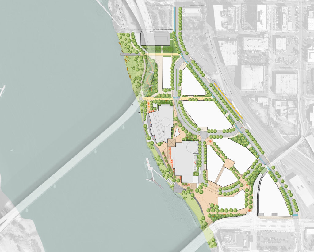
The masterplan would include the creation of a new street network. SE Water Avenue would be realigned to run further east, closer to the railroad tracks. “New Water Avenue” would include two vehicle lanes and a two-way cycle track, intended to link into the facility proposed as part of Central City in Motion. “Old Water Avenue” would be retained, but would primarily serve OMSI- destined school buses, cars, bikes and pedestrians. A new Loop Road would run through what is currently the main parking lot. The Loop Road would provide local access to the new buildings, including occassional large truck deliveries to OMSI.
New public space would include the South Plaza, adjacent to the Greenway, and between the OMSI Exhibition Halls and the Tilikum Crossing. A pedestrian only Central Spine would run from the existing streetcar stop to the museum front door. The existing East and West Plazas at the museum entry would be reimagined, with a new ticketing pavilion in the east plaza and new landscaping in both. “Tract A”, underneath the Marquam Bridge approach, would feature a realigned shared greenway trail and new riparian habitat.
Massing
Existing zoning on the site allows for buildings of up to 250′ in height. At the most recent Design Advice Request meeting the applicants showed three possible scenarios for how height might be distributed through the site.
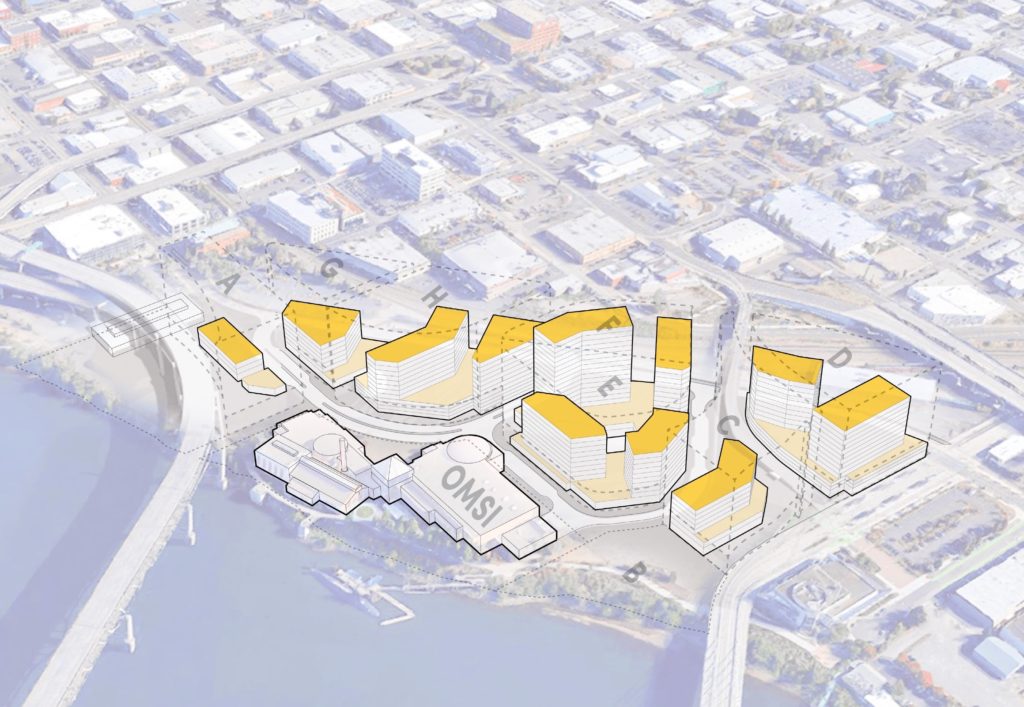
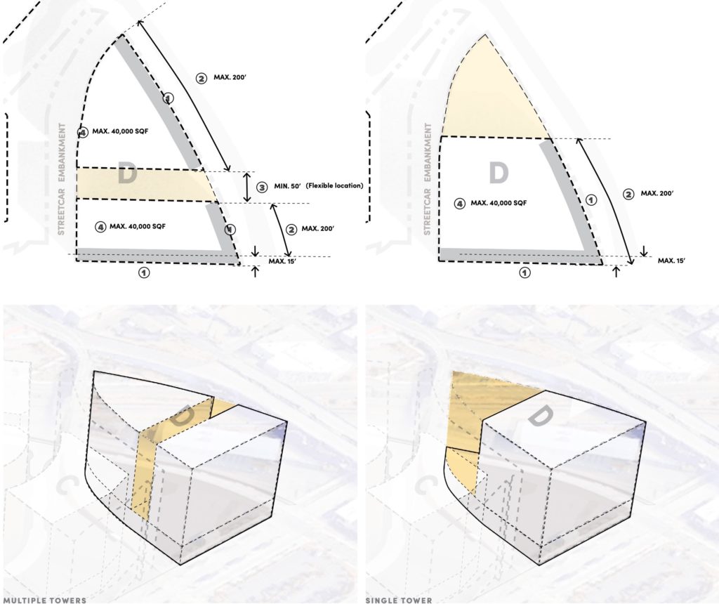
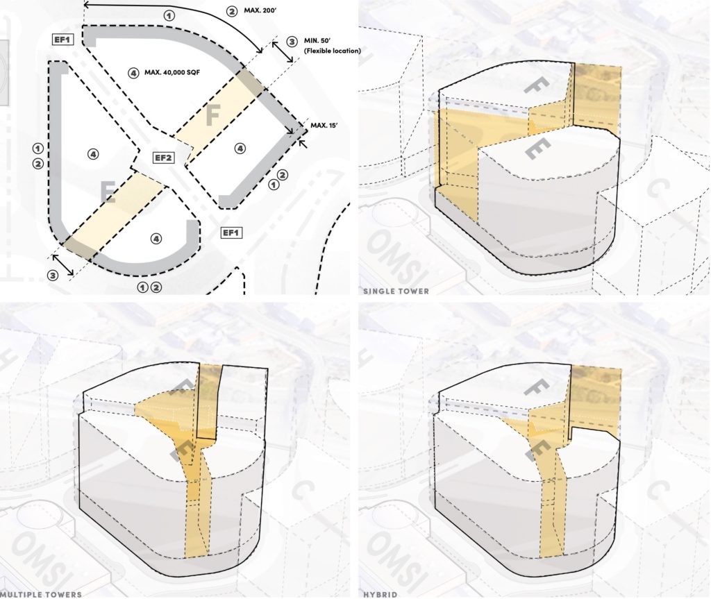
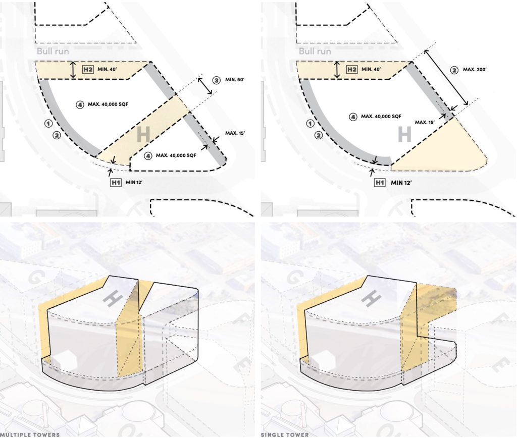
In the first example the larger tracts all feature two towers. Where blocks have two towers they would need to be separated by a minimum of 50′ from each other.
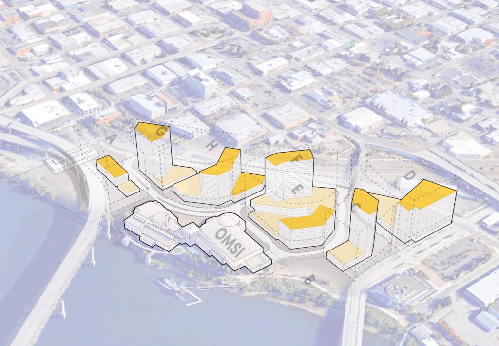
In the second example the larger tracts all feature one tower.
In a final example the larger tracts feature a mix of tower configurations.
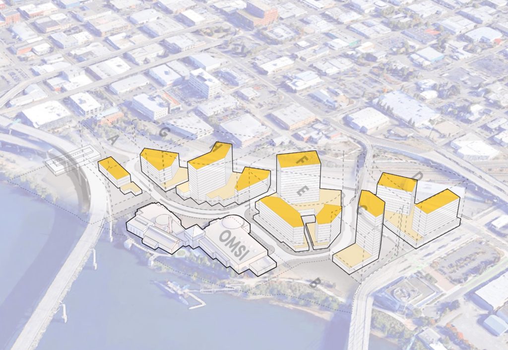
Tracts
Tract D would be located between the streetcar embankment and Water Ave. It could accommodate two smaller towers or one larger tower. Parking for Tract D would be above grade, due to expected geotechnical and water table issues.
Tracts E+F would be surrounded by the new Loop Road, with the Central Spine running between them. Both tracts are large enough to hold one or two towers. An open space of at least 70′ x 70′ would be located at the center of the two tracts. Parking for Tracts E+F could be located underground.
Tract H would be located between New and Old Water Ave, where the PGE substation is currently located. It is large enough to hold two smaller towers or one larger tower. Parking for Tract H would be above grade, due to expected geotechnical and water table issues.
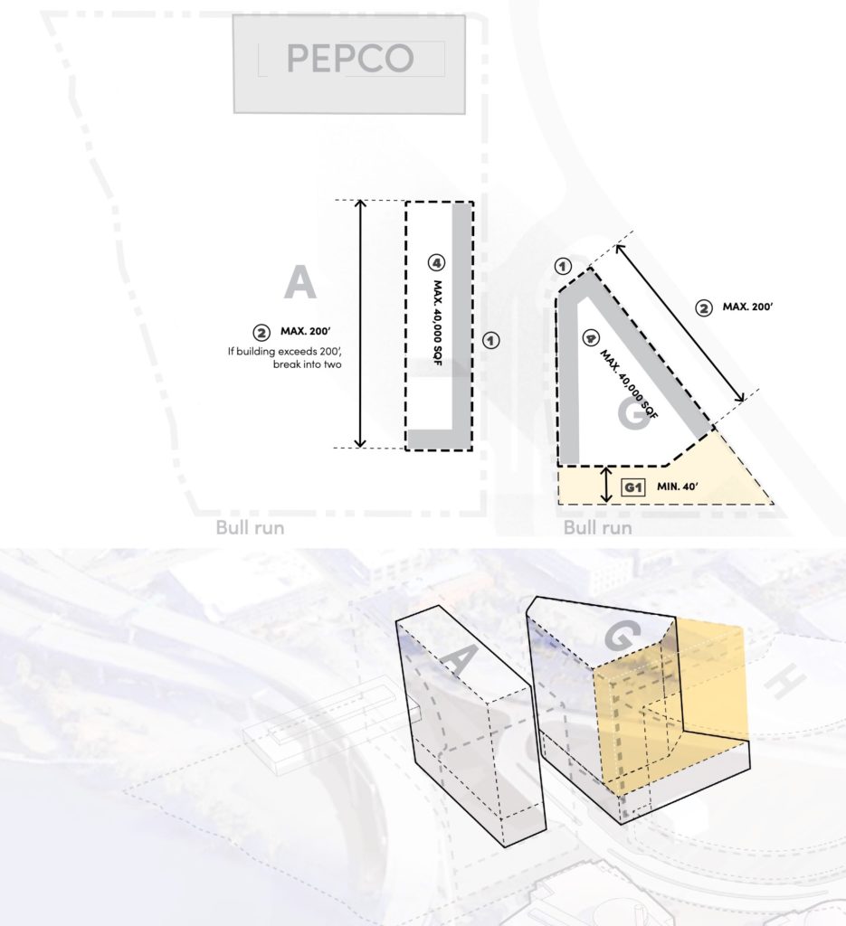
Tracts A+G would be located either side of Old Water Ave, north of the museum. Construction on Tract A is limited to the eastern edge of the tract, due to easements and required offsets from the approach the Marquam Bridge. Both tracts would likely only accommodate one tower.
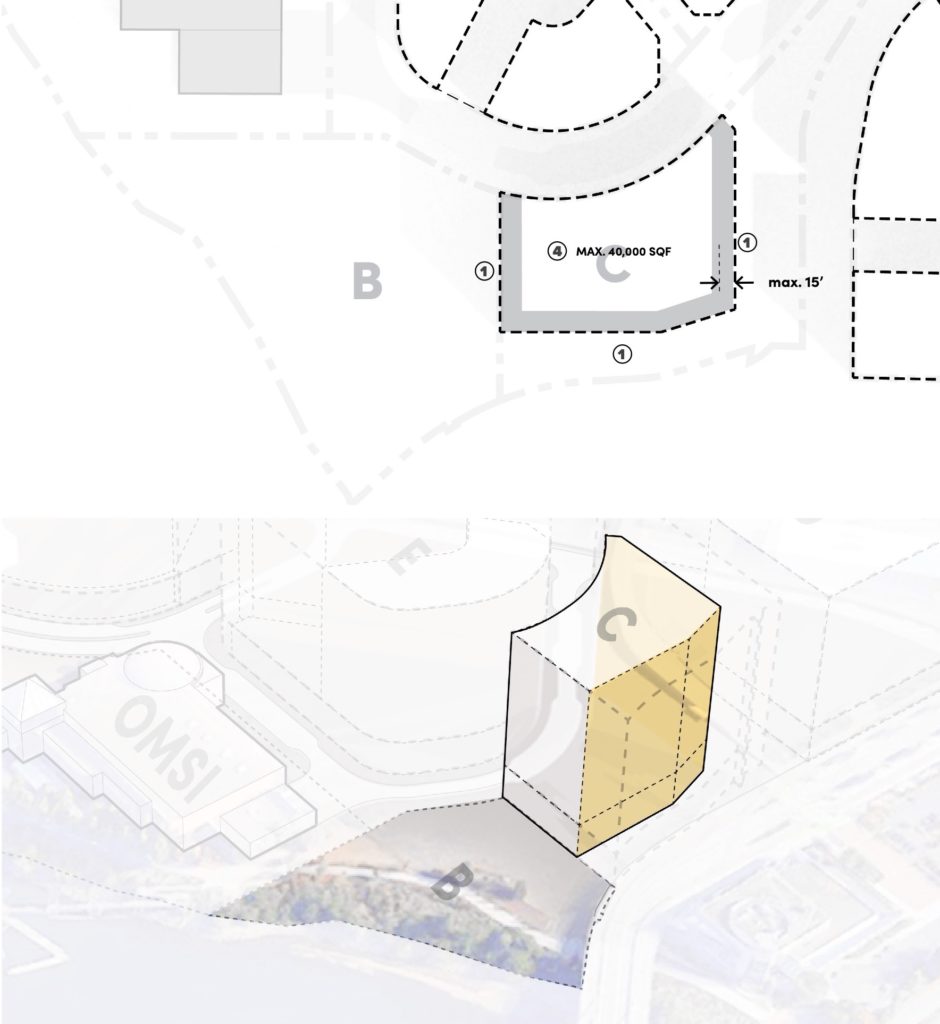
Tract C would be located between the new Loop Road and the approach to the Tilikum Crossing. It could accommodate one tower.
ZGF has presented the OMSI masterplan to the Design Commission twice: on June 6th and September 5th, 2019. A staff memo, published before the second meeting, noted how project had responded to comments from the first:
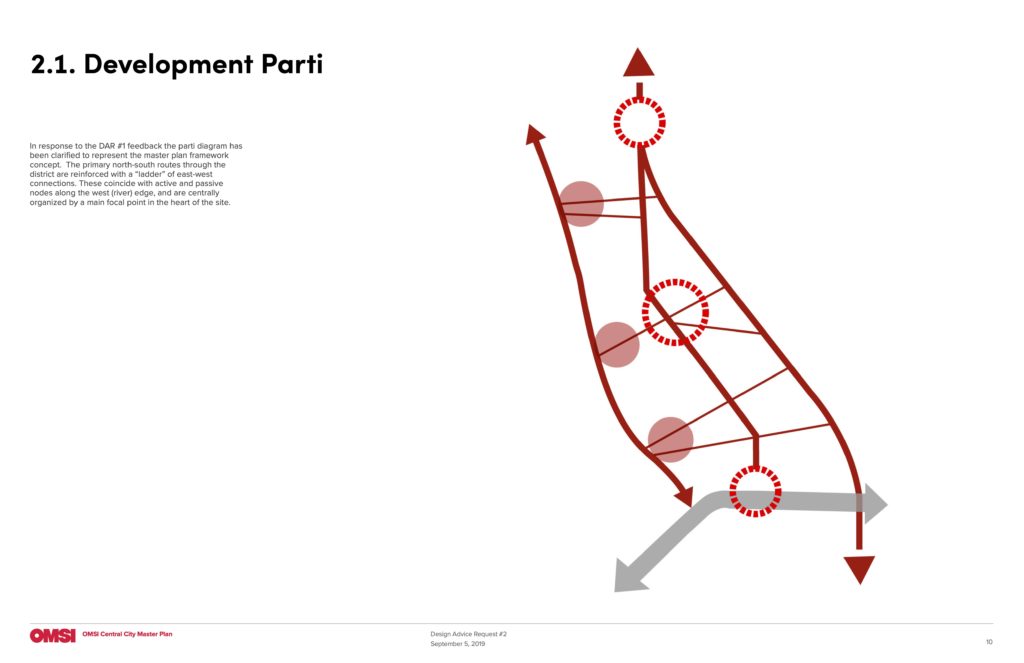
The development team has diagrammed a parti (page 10) to help organize the development. The three north-south connections are very strong and natural organizing elements, deriving from constraints of the river on the west and the railroad on the east. Major nodes lie along the “central spine” at the south and north ends of the site and at the OMSI plaza. These nodes are mirrored along the riverfront. East-west linkages connect between the nodes and north-south corridors.
i. The parti is conceptually strong and works well with the existing conditions of the site. The three north-south corridors each have their own distinct character that should be expressed clearly in proposed development. The parti also provides direction as to where additional emphasis and refinement of open spaces in the proposed master plan is needed.
ii. The parti is not as clearly expressed in the open space and street layout and proposed development pattern as it could be. Floor plates at the ground level are much larger and should be reduced in size to create more east-west connections, increasing visual and physical permeability through the site. Street and pedestrian connections at the south side of the site are much more curvilinear and create internally-focused open space and development rather than focusing open space and development towards the riverfront.
iii. The transit plaza at the south end of the spine is one of the major nodes in the parti and an intersection with the Green Loop, though the illustrative plans show this as a mostly transitory space. Regardless of the Green Loop’s actual route through or past the site, this node should be a well-integrated, active pocket park/plaza on the route.
iv. Consider how habitat corridors could be threaded through the site to help increase connections to the riverfront and influence the focus of development.
v. An internal connection has been added through Tract E, connecting the internal plaza on the block to the south plaza at Tract B. This connection gives the proposed internal plaza’s placement more meaning in the overall framework.
In order to gain approval the OMSI masterplan will be required to go through a Type III Central City Masterplan review. Individual buildings will also be subject to Type III Design Reviews.
Drawings
Development Parti 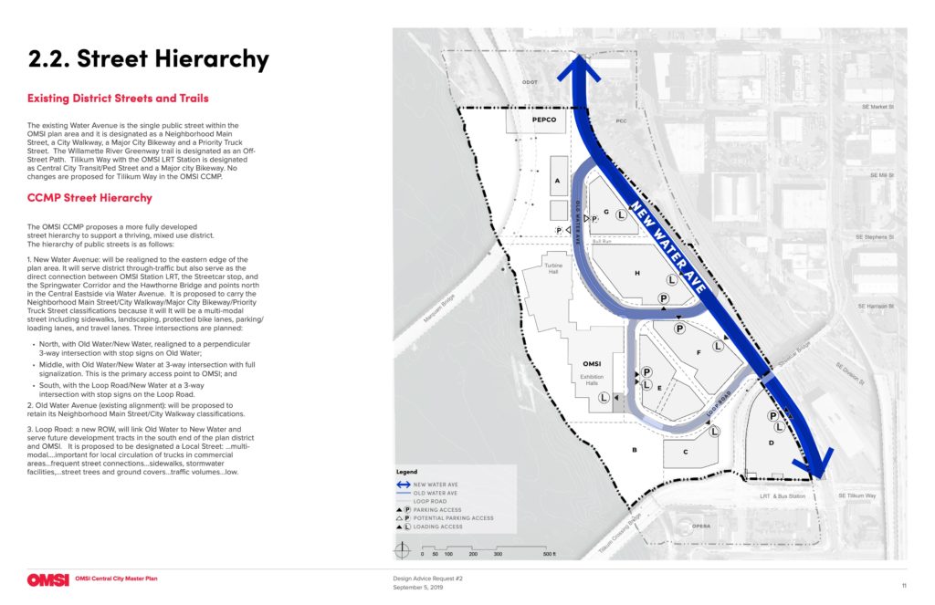
Street Hierarchy 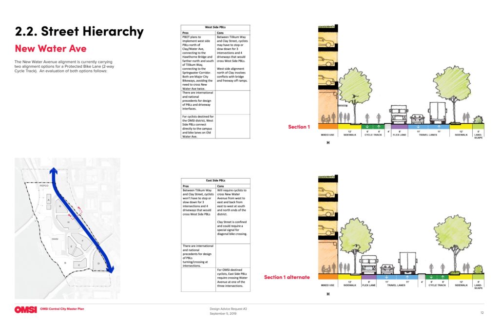
Street Hierarchy | New Water Avenue 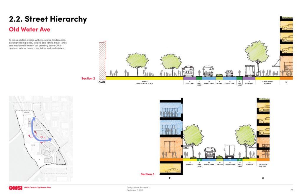
Street Hierarchy | Old Water Ave 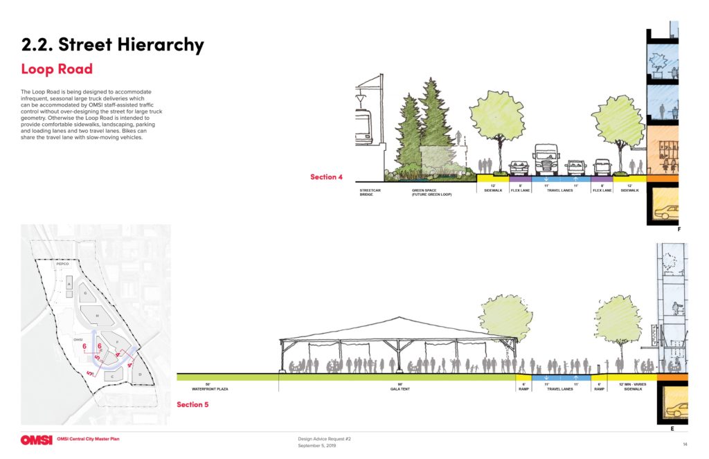
Street Hierarchy | Loop Road 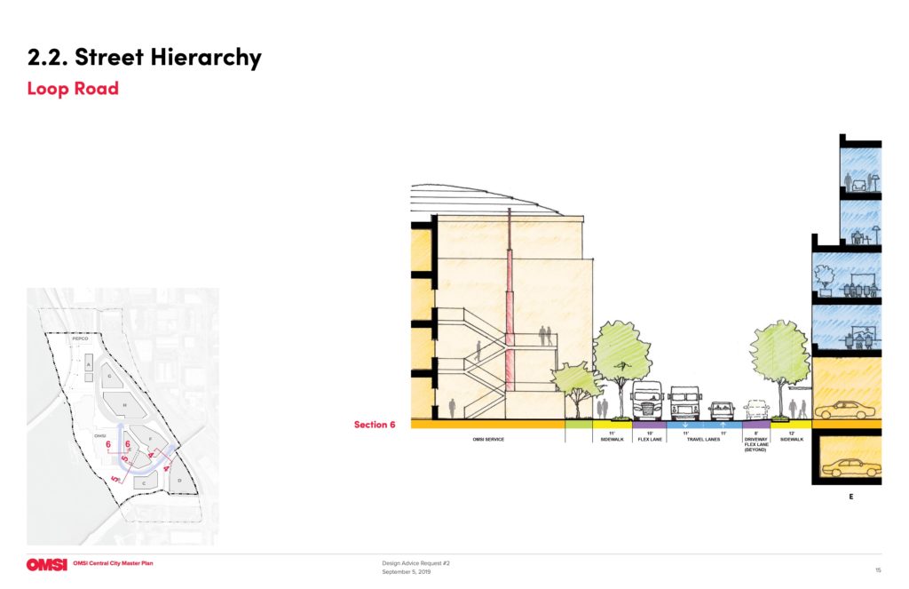
Street Hierarchy | Loop Road 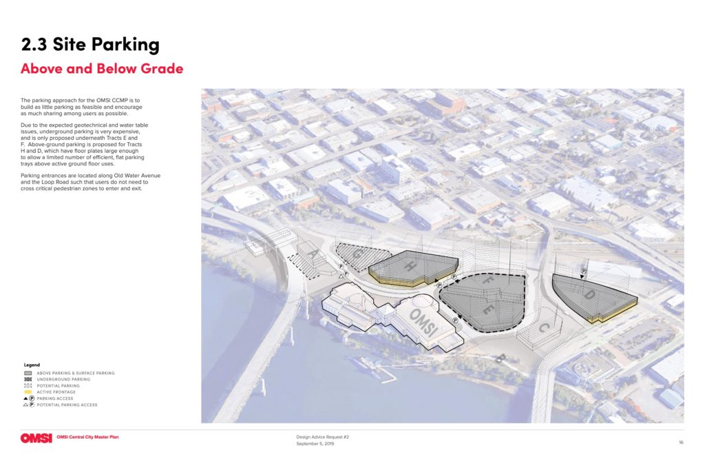
Site Parking 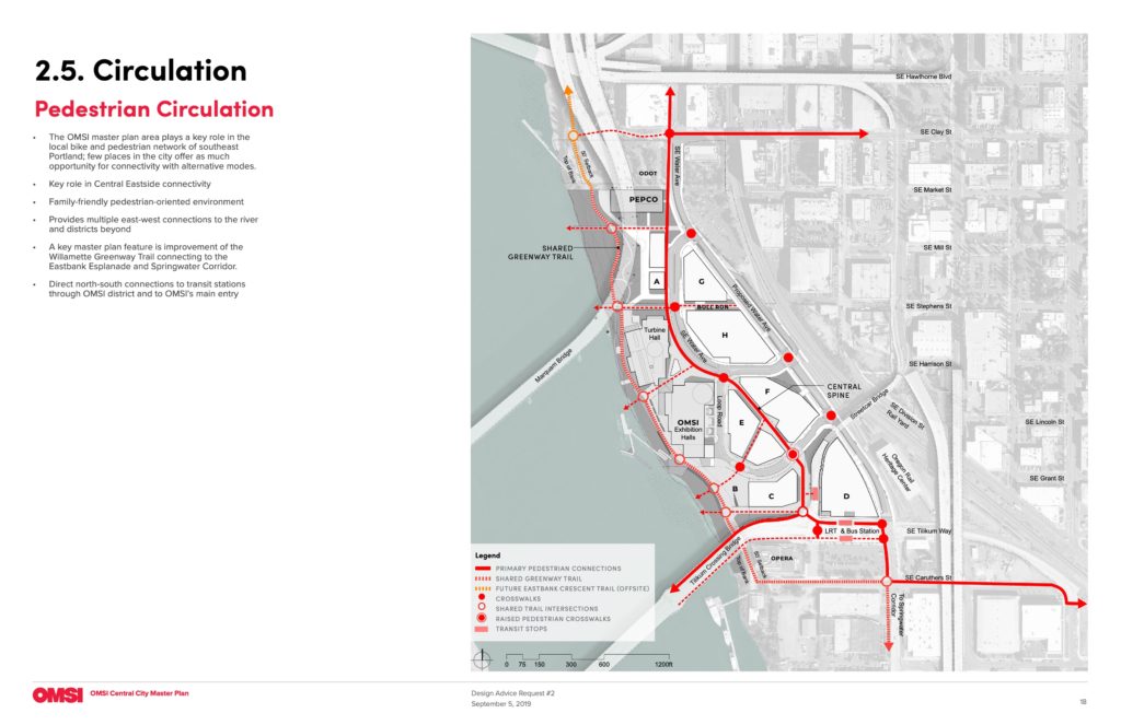
Circulation | Pedestrian 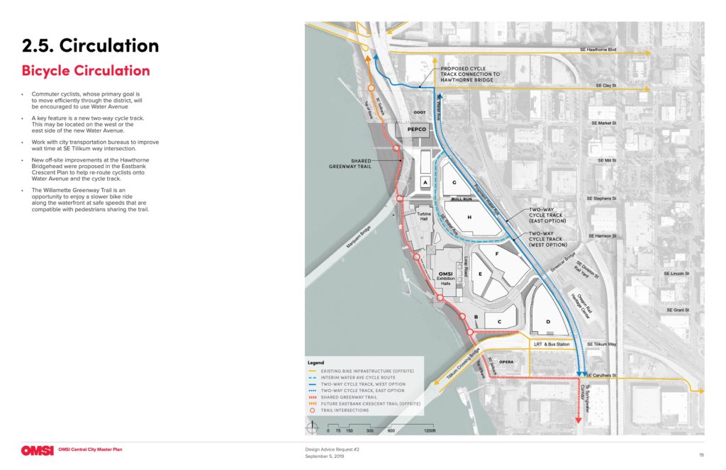
Circulation | Bicycle 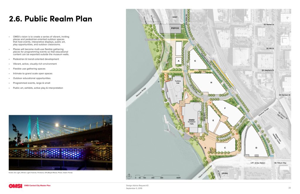
Public Realm Plan 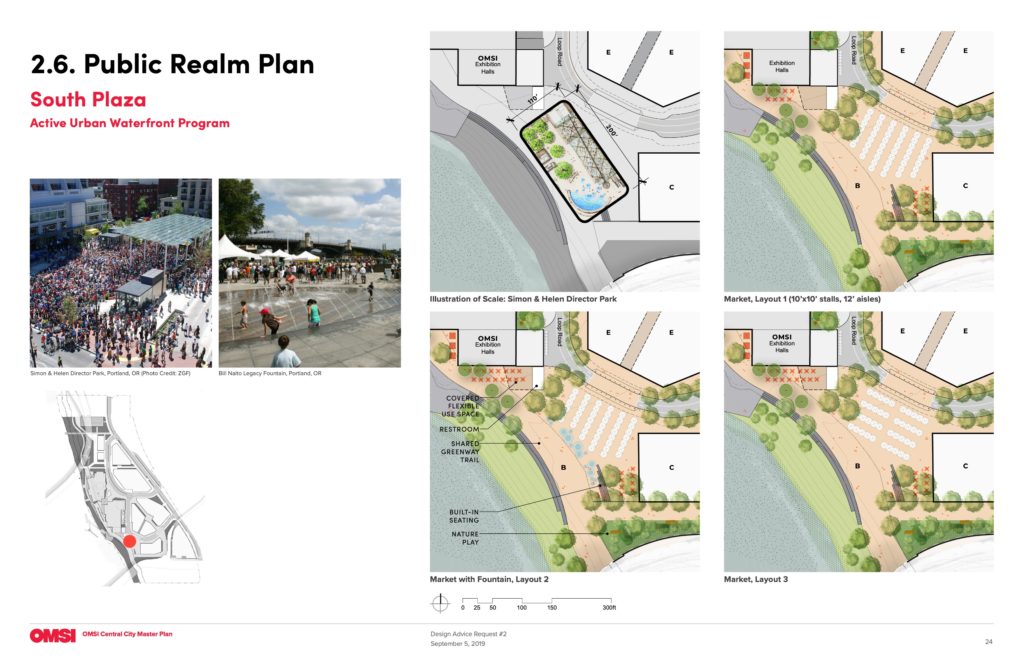
Public Realm Plan | South Plaza 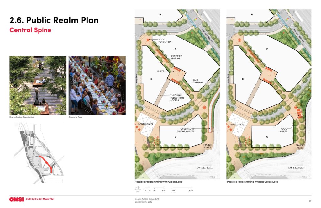
Public Realm Plan | Central Spine 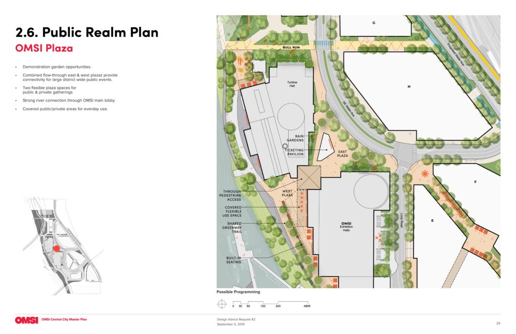
Public Realm Plan | OMSI Plaza 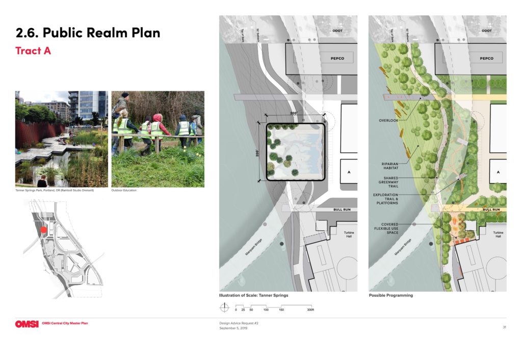
Public Realm Plan | Tract A 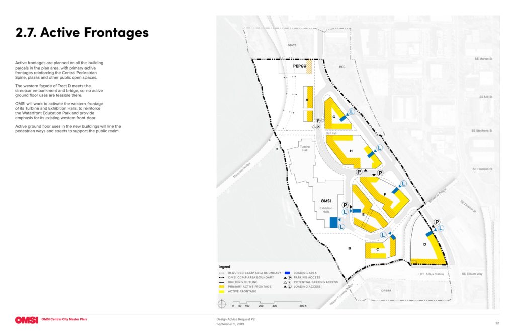
Active Frontages
This looks great. Looking forward to this being built.
I am surprised that they are not propoing adding a bike/ped connection to the streetcar bridge
See page 27
I would hope to see the loop road re-imagined as a one-way street with a single lane and parking/loading on one side; the additional 19′ could be reallocated to give wider sidewalks on either side, or a cycle track on the loop road.. They should also remove the one building parking access that’s on the loop road (for tract E; instead, provide a shared parking access where they show the tract F access). This would make it easier to close off the whole loop road for special events, or permanently except for delivery/loading vehicles.
So what breaks ground first? This project, the post office site, or riverplace development?
My guess is none for a long time.. these 3 projects imo is the most talked about projects that never do anything but plan plan plan over more talk talk talk
Don’t forget Lloyd Center,….The Lloyd.
Good lord, have a little patience. With the decade-long onslaught of new projects throughout the city, do you actually think things are moving too slowly?
This has got to be some of the best prime real estate in the inner city of Portland: restaurants, breweries and other amenities nearby, excellent access to pathways along the river to bike, walk and run, and finally, the view from these buildings of the downtown Portland skyscraper lights reflecting off the Willamette River. What a great place to work or live and be able to see the vibrancy of Portland all around you.